[ Casablanca ]
I love maps. Even more, I love the graph-theoretical exercise of superimposing arbitrary sets of vertices upon them, strung together with the most obscure, hard-to-find edges I can discover. Each vertex is assigned a value reflecting its level of interest, its beauty, the availability of supplies, the harshness of its climate. Each edge has a similar rating. Before long, I have pieced together an abstract latticework of connections representing a concrete challenge. Is this particular graph fun? Possible? Beautiful? Wise? Who knows: it’s a simple mathematical puzzle.
Except obviously it’s not. The reality of the exercise is far removed from these theoretical abstractions; I’m building my graph out of false bravado, second-hand information (of unknown quality and dubious origin), ill-advised daydreams, denial, and the general bliss of ignorance. My rating system intentionally ignores untrained legs and lungs and pending saddle sores, it downplays likely weather conditions, scales down the actual distances to wrap-head-aroundable, and pretends I’m the invincible Joe Mountain-Man. It studiously ignores all the silly mortality stuff that would generally keep me at home, sitting in a warm, climate-controlled room, drinking a cup of hot tea and reading a good book about someone else’s adventures founded upon ill-advised daydreams and the general bliss of ignorance.
What I’m trying to say here, however indirectly, is this: I’ve spent the past 24 hours doing a great deal of sweaty-palmed graph theory—playing pin the tail on the cartographical donkey—and the shite is about get all kinds of real. I’ve made a pretty big (and scary) decision regarding my route inside Mauritania [insert panic attack here], and—more immediately—I have chosen my route south from Casablanca, and through the high Atlas Mountains.
Donkey meet tail.
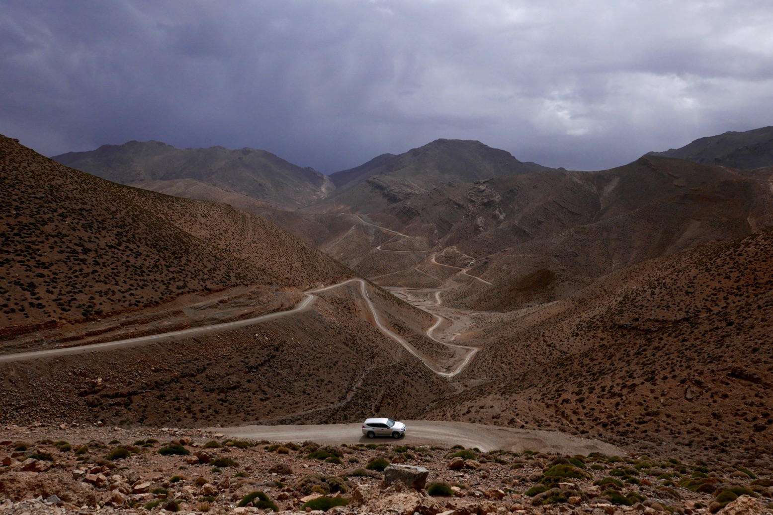
The featured image above is a major, remote section of that route. It’s a road that isn’t yet on any map of Morocco, with a crux represented by 80km of unsurfaced road climbing to 3042m—only a few miles away from Morocco’s second highest peak, Jebel Mgoun (4071m). The amazing folks at Sahara Overland have mapped it out, and the route is described in some detail here. Follow the link for some more pictures, and an idea of what counts as second-hand information (in this case, it’s pretty good, if limited).
I have committed to ride south from Casablanca on Sunday, wending my way slowly to Demnat (about 250km away) some days later. Perhaps a week? That first segment will look something like this. From there, I’ll switch to the Sahara Overland’s “MH19” and hope for the best.
And that, friends, is about as real as it gets. It’s time to hit the road, and not merely the roadmap.
See you soon,
—jim
PS
As part of all this map-gazing, theorizing, daydreaming I learned that the Mauritania visa is now available on arrival at the border. A much easier way to take care of it. Hence my departure on Sunday.
—j


